Know what's inside the concrete before work begins.
Camber Aerial documents buildings from the air. For what's embedded in slabs, walls, and decks, we work with an independent ground-penetrating-radar specialist: GPIS Concrete Scanning & Imaging.
GPIS uses ground-penetrating radar to evaluate concrete slabs, walls, and ceilings before cutting, coring, drilling, or anchoring. Findings are marked directly on the concrete surface, so the contractor can see the approximate location and depth of reinforcing steel, conduits, post-tension cables, pipes, and other detected embedments before a blade touches anything.
When documentation is required, GPIS provides a detailed end-of-job report in PDF form covering scan scope, findings, approximate depths, site photographs, marked areas, limitations, and recommended clearances.
GPIS works with contractors, structural engineers, electricians, plumbers, property managers, facility operators, and building owners throughout Chicago, Illinois, Indiana, and surrounding areas.
- Concrete floor, wall & ceiling scanning
- Rebar & wire-mesh mapping
- Conduit, pipe & post-tension cable detection
- Slab-thickness & embedment-depth documentation
- Pre-cut, pre-core & pre-anchor scanning
- On-site surface markings
- Photographic end-of-job reports
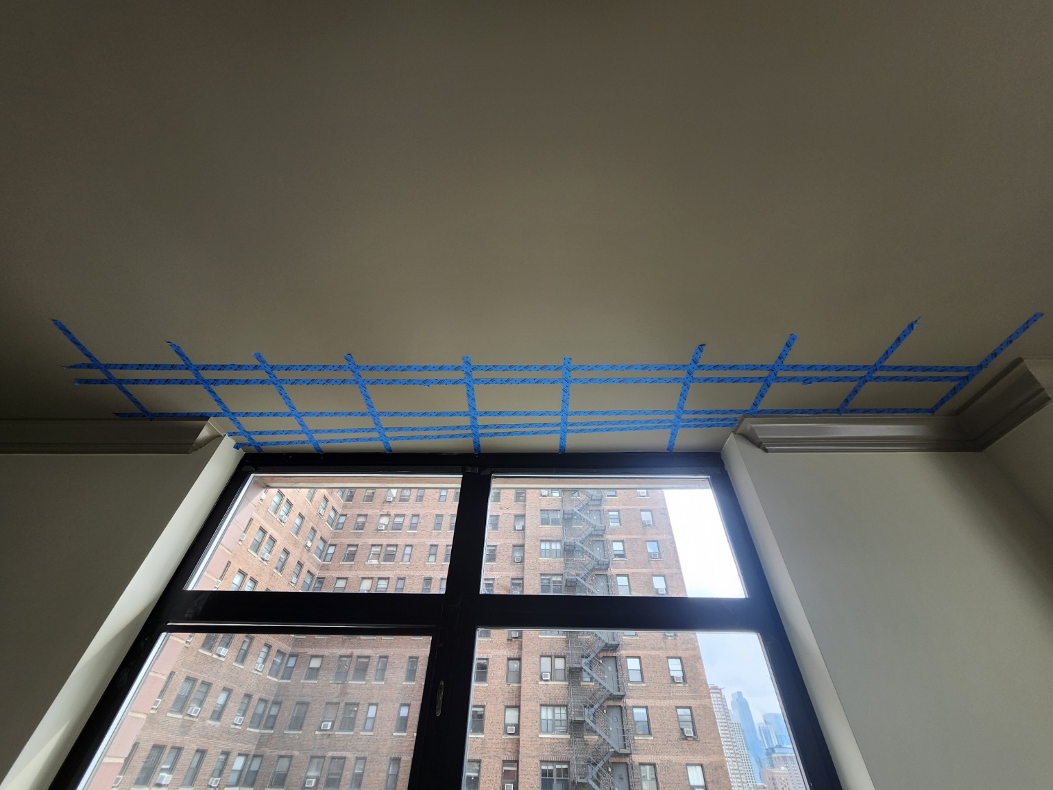
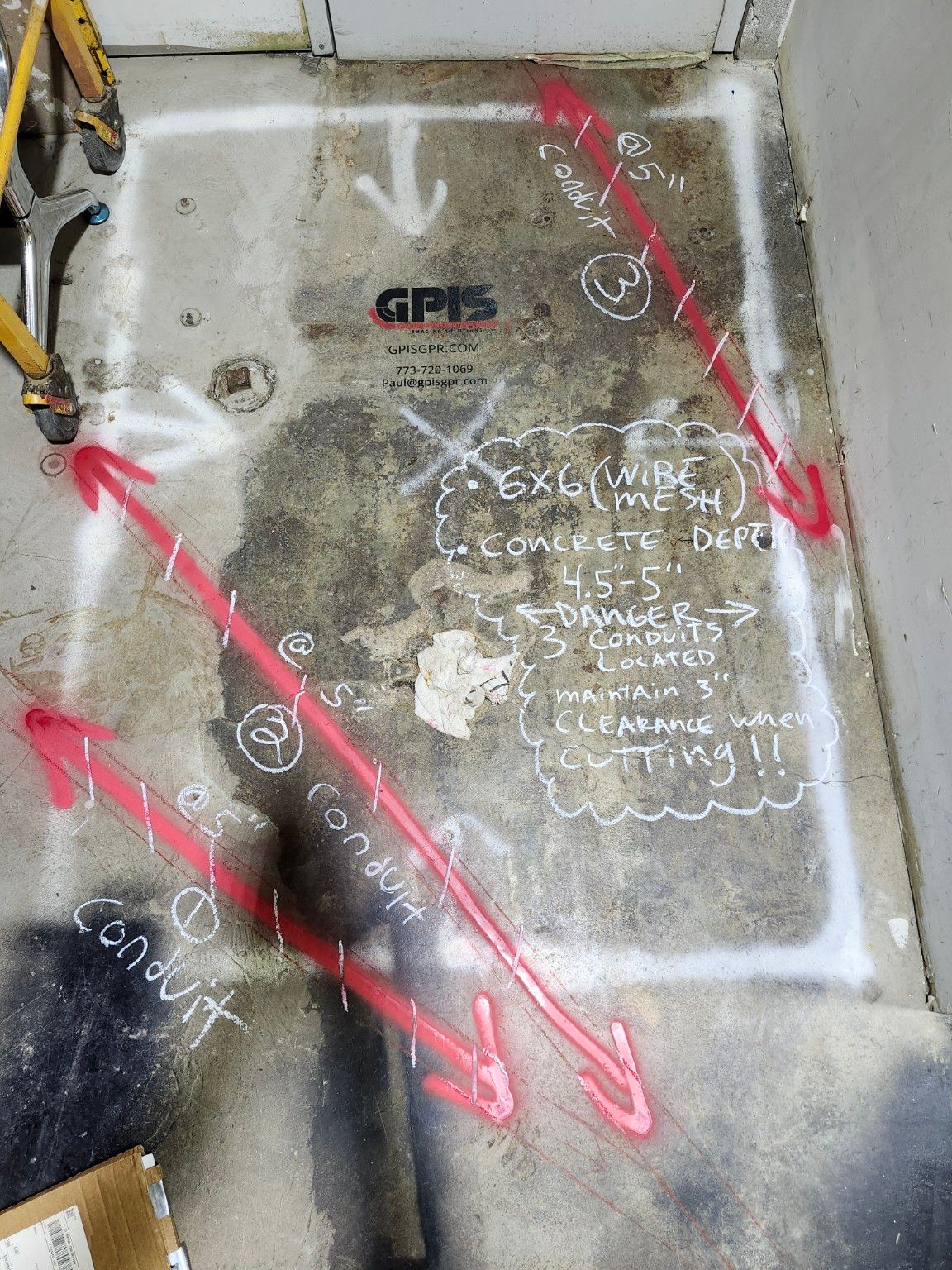
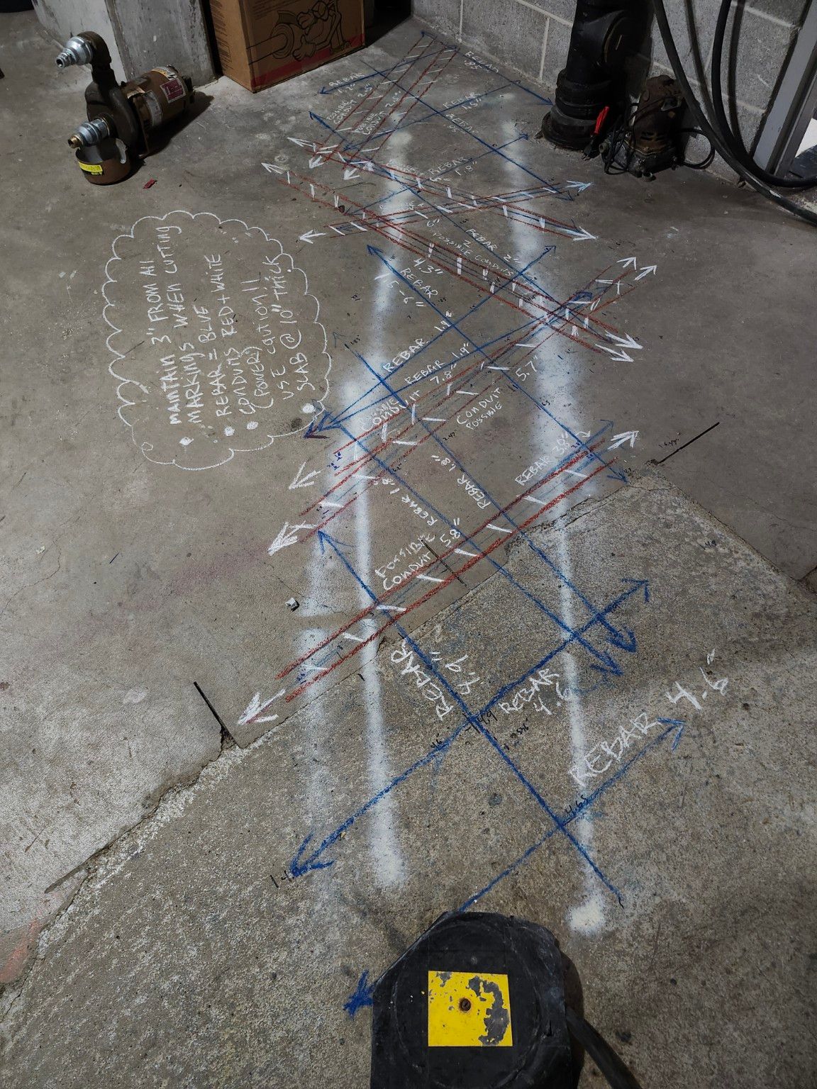
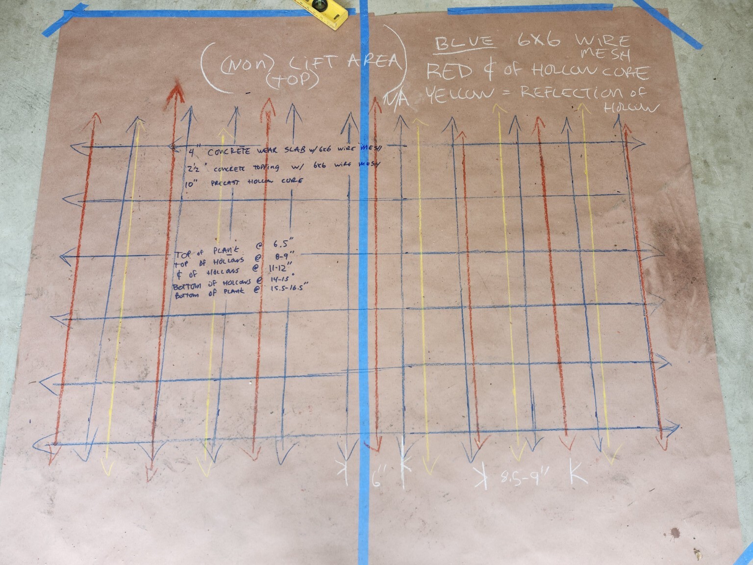
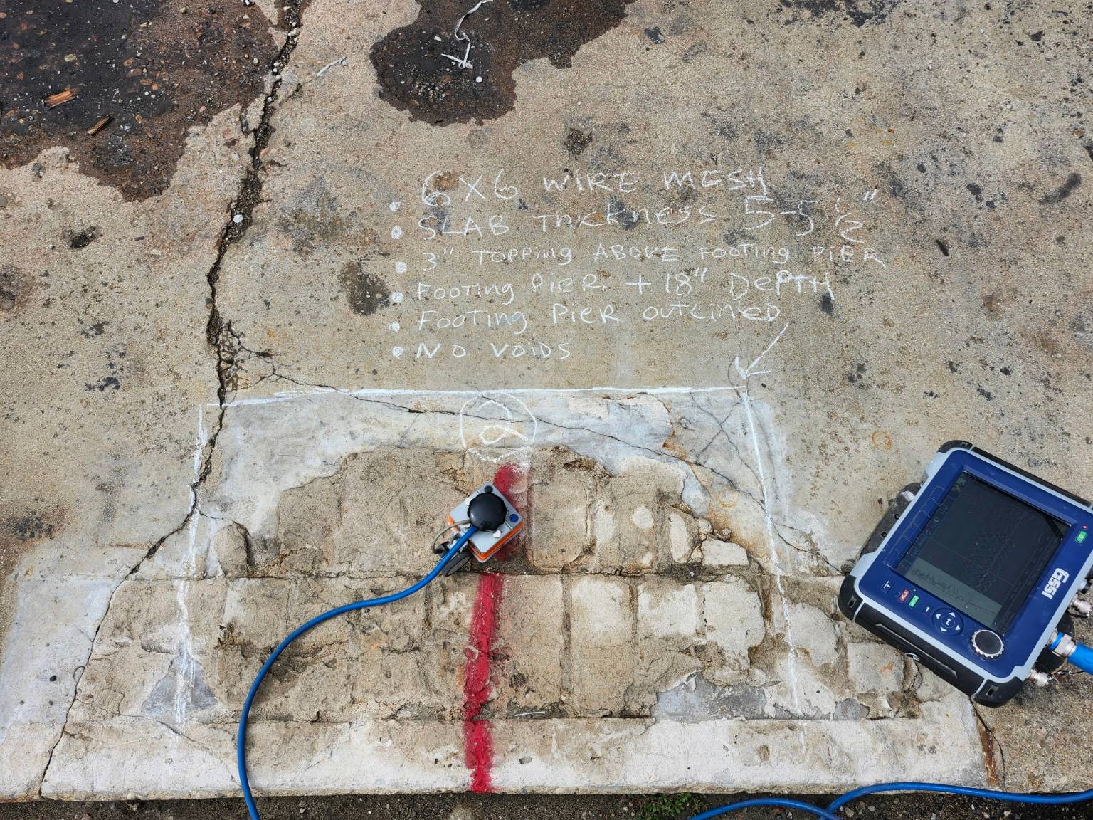
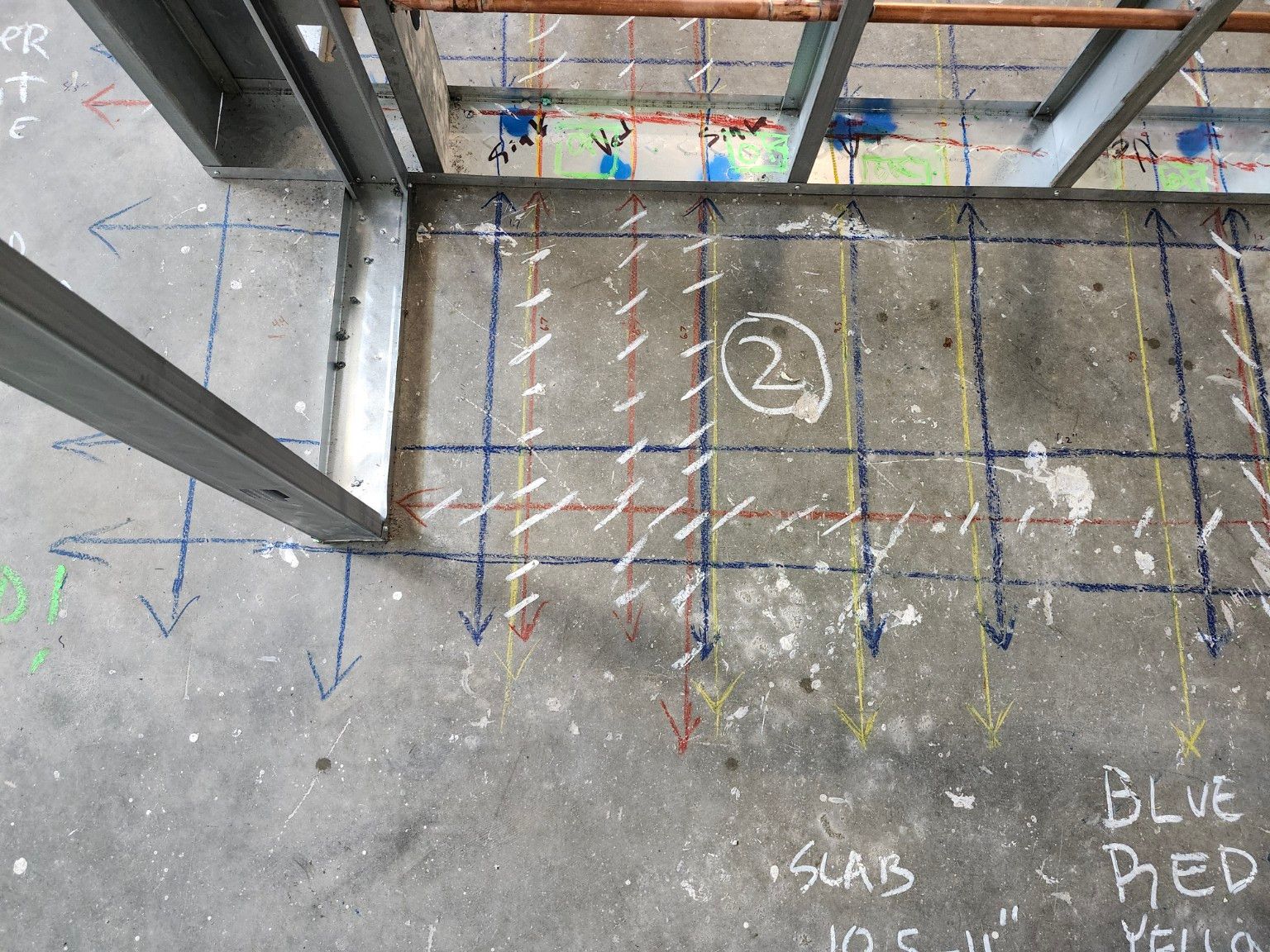
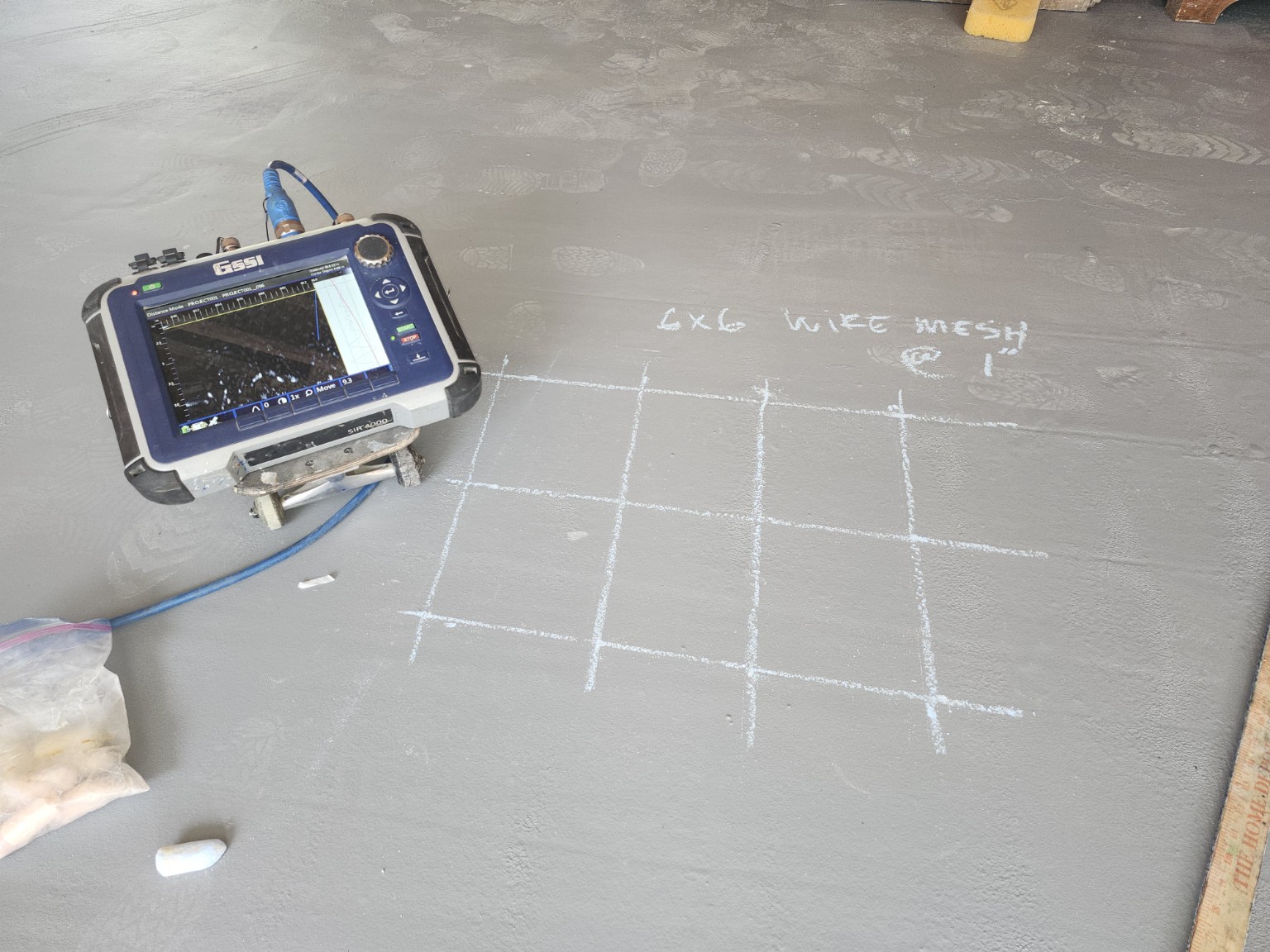
The findings are written on the concrete.
Each line marks something the radar found, labeled with its depth. Each job's color key is written on the slab, and so are the clearances to keep when cutting.
Some jobs need both sides.
Parking structures, building investigations, and construction projects often need the elevations documented from the air and the concrete mapped from the ground. Camber Aerial and GPIS work these as separate companies on one job — each responsible for its own scope, each reporting in its own name.